 I have been involved in adventures for around 8 years now, beginning with a trek across the Sinai desert which was an eye-opening experience, and led to a taste for adventure which is hard to quell. Each year I think of a host of adventures until a suitable option arises and then pursue it rigorously. My travels have mainly been in Europe, with my longest expeditions in Scandinavia teaching me a great deal and providing the experience necessary for the bigger trips.
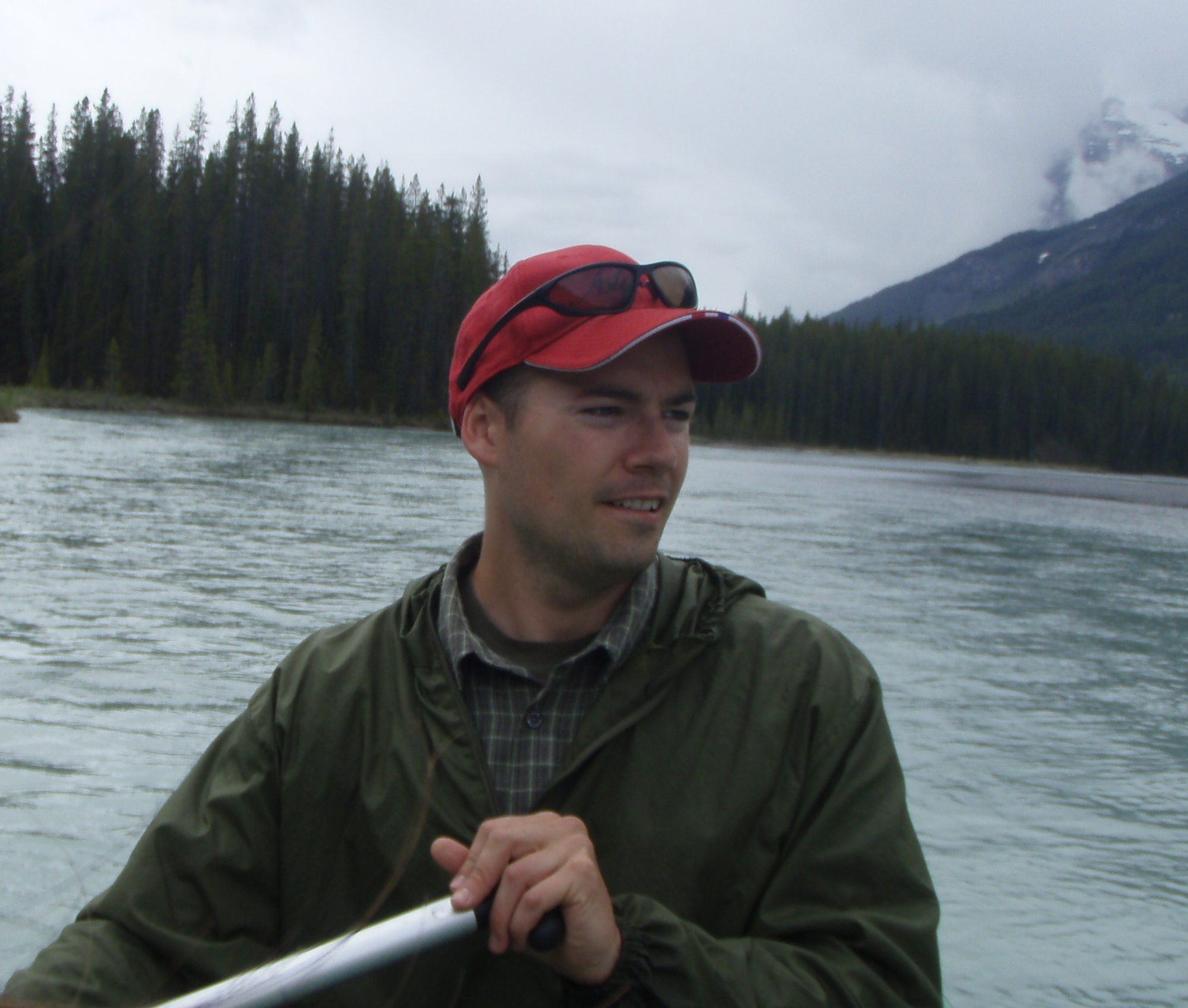
After studying Anthropology at Roehampton University, London, I set my sights on large expeditions in distant lands – and ended up in Canada.
I now live in Jasper, the heart of Jasper National Park in Alberta, Canada, which provides no end of adventure for those so inclined; hiking, mountain climbing, snow-shoeing, canoeing, and even a little snowboarding for the change of pace and scene. Living in Jasper National Park is a great experience and the vast expanse of mountainous wilderness allows me to practice those skills I value the most; Bushcraft. Outdoors-men such as Mors Kochanski, Nessmuk, Ray Mears and Bill Mason provide guides for the knowledge required in this environment, and the likes of David Thompson and Sir Alexander Mackenzie and their tales of exploration in this area and on these very rivers stimulate my appetite for adventure!
________________________________________________________________
Je suis dans le monde d’aventure depuis maintenant 8 ans. Tout a commencé par une randonnée pédestre dans le désert de Sinaï qui fut une expérience qui m’a ouvert les yeux et m’a donné un goût d’aventure dure à refouler. Chaque année depuis, je pense à plusieurs aventures possibles de faire jusqu’à ce qu’une option appropriée s’offre à moi et que je poursuivrai avec acharnement. Mes voyages ont été principalement en Europe, avec ma plus longue expédition (5 semaines) en Scandinavie qui m’a appris beaucoup et procurée l’expérience nécessaire pour entreprendre de plus gros voyages.
Après avoir étudié l’Anthropologie à l’Université Roechampton, London, j’ai posé mon regard sur des contrées lointaines qui seraient appropriées pour de longues expéditions – ce qui m’a amené au Canada.
J’habite maintenant à Jasper, au cœur du Parc National de Jasper, en Alberta, Canada. Ce parc offre de multitudes activités à ceux qui le veulent bien: randonnée pédestre, escalade de montagne, canot, raquette à neige et même un peu de planche à neige pour faire changement. Vivre dans le Parc National de Jasper est une grande expérience et le vaste terrain montagneux sauvage me permet de pratiquer les savoir-faire que je vénère le plus : le bushcraft (l’art ou le métier de la brousse), la vie sauvage et la survie en forêt. De grands hommes de plein air tels que Mors Kochanski, Nessmuk, Ray Mears et Bill Mason me servent de guide pour apprendre les connaissances requises dans un tel environnement alors que David Thompson et Sir Alexander Mackenzie avec leurs histoires d’exploration dans cette même région, dans ces mêmes rivières stimulent mon appétit pour l’aventure!
Ben Roche
hey Ben,
i am planing on paddling from the columbia glacier to jasper later this month. i was hoping to chat with you first. it seems that you two may be the only folks that have done it!
cheers bud
hope to talk to you soon
michael
Hi Michael,
There is a little information available on a few km’s above Athabasca Falls but from my research before the trip we were the first to have done it fully. Really dependent upon what time of year you are going, we canoed at the opening of the river, high water and end of year just to see it all at it is an exciting ride in low water! Very very shallow, lots of 90 degree turns or greater with switchbacks so you have to be on your toes. And for sure watch where you are coming up to Athabasca Falls, it surprised us a few times! The section just after is really exciting, you’ll paddle like crazy but it’s very rewarding.
Best to use a shorter paddle blade. We used the sturdy white-water style and they worked well. You’ll find the blade scraping the bottom a few times in very low water. You should be ok for the most part in late May, and should be coming up on the high water so it’ll be fast and the turns less dramatic. Good sized haystacks in a few sections but the big rocks should mostly be hidden and you probably won’t strike them given the water level. Are you going in a canoe or kayak?
Happy to chat, weekends or evenings best for me. Give me a few days and I will dig out my notes on the section and refresh my memory.
Ben
Hello Ben,
First of all, congratulations on completing such an amazing journey. My hats off to you. I too am interested in canoeing the Upper Athabasca River. It might be a couple years away still, as I would like another year or two to improve my skills a bit more. It would be a solo trip, so I want to make sure I’m good and ready. Just a few questions if you don’t mind. Does the river look canoe-able right from the glacier? Would you say the class III is pretty continuous? Lots of tight corners with sweepers and strainers I’m guessing. Is there signage or anything alerting you to approaching Athabasca Falls? I plan on canoeing from just below the Falls to Old Fort Point next summer. After that, I would like to try and canoe as much of the upper section as possible. If you could spare any thoughts or details, it would be much appreciated. Thanks, take care.
Nick
Hi Nick,
Thank you for your comments! Great to hear you are preparing for some adventures and I’ll certainly help any way I can. The upper reaches of the Athabasca are fun to paddle but very technical as there are many rocks, tight turns, switchbacks, shallows, haystacks and the like. For our training before our expedition we paddled it many times, and below the Athabasca falls to Old Fort Point many times also. We went in low water at the very beginning of the season, in high water during flood, and at the end of the season. It changes dramatically as when the water is low, rocks are everywhere and most of the tight turns you must take the current flows over rocks and we touched the bottom a lot on the way down frequently. In high water the current is so high and fast that you’ll be done in no time, and the rocks and corners are less of an issue as you just rocket through. Just the bigger ones to worry about and the bigger bends in the river. The are we had most concern and got jammed on a rock once in lower water was at the confluence of the Athabasca and Sunwapta rivers. Where they join the river really picks up speed, there are a lot of rocks right in the middle and the current pushes you to the left bank where rocks are waiting for you. You can stop within sight of the confluence a little ways up and scope out the entrance which helps to judge your path before committing, but commit you must as there’s no place to stop for a while once you enter this canyon. The rocks lessen as you progress however. The class of this section of river is really water level dependant. We have had easy runs and very difficult ones, but this came with practice also. There are occasional sweepers and strainers but there was nothing we could not manoeuvre around. We had far more problems with the further down river just outside of the National Park.
We found at the beginning of the season that we could only travel a couple of km’s above Athabasca Crossing campsite to put in the canoe. It was too shallow beyond this as it is close to this point that the valleys converge and the water flow increases substantially. If you head up the Columbia Glacier valley itself the water is far too shallow, more a trickle from the glacier. It may be different in summer, however it would be exceptionally challenging to get to this point with the water higher. Were the water higher and stronger I am not sure it would be feasible to get the canoe further upriver unless wading upriver pulling the canoe, but again, perhaps the river strength by this time may prevent this. There is no signage when you are coming up on the Athabasca Falls and I was always incredibly apprehensive about this part. I used the Mountains Kerkeslin and Hardisty to approximate the position of the Falls as I got closer, and counted the turns but we were surprised a couple of times thinking it was a bend further ahead than it was so my method was not foolproof. The river is relatively wide, then it turns sharply and narrows with rocks on your left and a solid wall to your right. The haystacks here are large and we were swamped on one occasion during the high water period with the canoe sinking halfway through, leading to us rather unceremoniously swimming for our lives above the Falls trying to swim with the canoe to the shore. There is technically a portage trail around this point on the left bank but I never trusted this and never went left. My consideration was this is the most forceful line of the river and if you miss the portage point or make a mistake you will be swept over the Falls. I always paddled the stacks and went right immediately as you come out of this little gorge. The river eddies here so it is much easier to get to shore, and gives you a far greater chance of recovering from a mistake. I can’t stress this enough, this part is incredibly dangerous. A mistake here could cost you your life and we had a chillingly close call. Though we went back again and again to perfect it, always taking this course. It is also a great rush to come out of a long rapid section, a really fast corner and the roar of the Falls ahead. You’ll photo-bomb some tourist snaps as well I guess. I think this tight turn and the wall of rock prevents you hearing the Falls well before arriving at them.
The section below the Falls is brilliant. I love it. We paddled it loads and always had a thrilling time. The initial part is the most dangerous and technically challenging, but it is a beautiful section of canyons, gorges and hidden beaches. I have never rafted it, but Vicki had before and this would likely be a great way to learn this part of the river before paddling it. My recommendation would be to walk as far down along the bank as possible to see how the current moves. It tries to push you into a giant rock initially, then sweeps you into a tight left-right-left and picks up power and speed as it goes. Lots of rocks and at low tide is wonderfully difficult, with the current seemingly trying to smash you against the large left-hand bend canyon wall. We were laughably poor at our first attempt, but had a wonderfully satisfying second run after doing some more ‘skill improvement’ just by reading canoe theory about manoeuvring through rapids.
We used a 16.5′ canoe and were I canoeing solo I would likely use a shorter one so I could more easily kneel in the middle and really move it around. Some parts really need to be muscled through and my canoe has wear from the hard levering and prying off the gunwales, mostly from these sections. They are such fun though, I really hope you have as a great a time as we have paddling these. You’ll do it once, realise how much sweeter it would be now you know the route and can really enjoy it without the anticipation of not knowing what is coming next and want to do it again! The section above the Falls is very infrequently travelled and I hadn’t met anyone who had done it before going myself so information was hard to come by. I couldn’t find any information. I obsessed over Google Earth, we drove to every section you can see from the highway to study it and then just went for it. If I can help further just get in touch again, and if not before you paddle, please let me know how it goes! I would love to hear your experience. It was the most technically demanding of our whole trip, and definitely the most fun.
Good paddling,
Ben
Hi Ben,
Wow, thanks so much. That is more info than I could have ever expected. I really, really appreciate you taking the time. I will definitely let you know how it goes. Again, it will probably be in 2019. When I go, I hope to film as much of the canoeing as I can. Before then, I will be practicing in more class III, and also hiking along the upper Athabasca to see it for myself. I am aware of the serious dangers involved, and want to be fully prepared. Thanks again Ben, you are a fountain of knowledge. Take care.
Nick
Hello Ben,
Hope you are doing well. I just had a couple questions if you don’t mind. I’m getting really excited about the prospect of canoeing the upper Athabasca. Can’t stop thinking about it. Depending how it goes this spring practicing in tougher class III’s, I may have a go later in the season. Based on what you said, my best option will be to canoe from the Crossing Camp to the falls. Further up river doesn’t sound like it’s very feasible… more like packrafting territory. Do you know how many river km’s it is exactly from the Crossing Campground to Athabasca Falls? My best guess is around 31km. I will be in a 15.5′ canoe. Old school whitewater canoe with lots of rocker, and flotation. Kneeling thwart right in the center. I will be lightly loaded as I will have very minimal camping gear with me.
I am also considering a hike up to Columbia Glacier at some point. I know it is 15 or 16km from Sunwapta Falls to the Crossing, is it 32km from the Crossing to the glacier? I think that’s what it said in your video. Is there any trail in the forests when you cannot hike along the river flats? You guys went in April. Best time to go?… in regards to river levels and possible dangerous fords. I am not apposed to winter hiking and camping.
Also curious… Have done any more big adventures? I read somewhere that you were thinking of paddling to the Pacific and Atlantic Oceans as well. Sounds amazing!!
I have one more question. The fellow who commented above in here. Did he ever get back to you in regards to his paddle from Columbia Glacier to Jasper?
Thanks so much Ben. You have been very helpful, and I shouldn’t need to bother you with any more questions:)
Take care,
Nick
Hi Nick,
Reviewing my plan I had a distance of 39km noted from Athabasca Crossing Campsite to Athabasca Falls, though I do not recall now how precise or approximate this distance is.
As for the distance from Athabasca Crossing to the Glacier, 31-32km is quite accurate, though will entirely depend on how you can get there. We travelled on snowshoe and had a difficult time up to Habel Creek. Beyond this we didn’t need the snowshoes and the terrain was almost entirely flat and almost a pleasant stroll!
At the end of the season I would have no idea what it would look like, my guess is the path we walked would not exist when there is no snow or ice. It was certainly a challenge on the way back once the snow bridges we had used disappeared, and this happened within a few days. There is no discernible trail that we could use. In my research I had found out about a long unused trail that used to run along the Eastern edge of the river up beyond Athabasca, and although we could find some evidence of this trail, it was so overgrown that it was impassable to us.
As we only travelled to the Glacier once, I am not in a position to advise on best time of travel, but were I going solely to the Glacier and not incorporating it into a paddling journey I would have gone earlier. Perhaps just a couple of weeks. Early April or late March. This way it would not be during breakup and the snow bridges and other snow/ice areas would be more secure. More than once we broke through the snow into the river which could have been dangerous had there not been a partner around to help free the other.
We are still planning our further paddling expeditions, but since this trip we have been building our off-grid home which was a far greater project than I had imagined, though coming along very well and is now a comfortable home. I am also a Wildfire Fighter and so my summers are far busier than what they once were!
Unfortunately I have not heard whether the previous poster paddled the Glacier to Jasper, so please, if you do so, I would greatly appreciate if you could post what you would be willing to share of your experience with us here. It is a tough, challenging section and I loved every minute of every time we took the journey. I would really enjoy hearing from someone else who has done it.
No worries about the questions, I am happy to share what I can. Take care, and fun paddles!
Ben
Hello again Ben. Just wanted to let you know that I did the falls to Old Fort Point section on May 13th, and loved it!!! What a run!! The flow was at 175 cms, lower end of the scale I suppose, but enough flow that rocks were not a problem. Higher water I know it would be a very different river. Played it pretty conservative in the beginning stretches, once past Kerkeslin ledges I felt pretty confident. Got slapped around a couple times be some bigger waves, Becker’s gave me a good test, but all in all it went very well. Makes me want to do the section above the falls even more now. Will likely do the falls/old fort point section a few more times at different water levels. Once the highest waters start coming down, will seriously be considering the Athabasca Crossing section.
I posted a video on you-tube of this trip, called Canoeing the Athabasca River – Athabasca Falls To Old Fort Point. You have to trust me that this is not a shameless plug:) But if ever get a bit of down time and can check it out, please let me know if I have any business canoeing the Athabasca River solo above the falls. As always, thanks very much Ben.
Take care
Nick
Hello Ben,
I did some scouting above the falls this past weekend. Yeah that last class III before the falls is no joke. Did you have a specific line that you would take (at moderate water levels)? It looked like there were a couple of waves to avoid, necessitating a bit of side slipping. I will have to try and avoid taking on too much water, or swamping all together, yet hold a decent line so I can exit and immediately get right and look for an eddy. It appeared there were a couple of take-out options. Did you take-out of the river right along the highway, or at the eddy/pool much nearer to the falls?
Hope you’re having a great summer, and thanks as always Ben.
Nick
Hi Nick,
Firstly, my apologies for the delay, I am a Wildland Firefighter and this has been a busy season in Alberta with plenty of exports to other provinces so I haven’t been at home much with down time this summer.
Thanks for posting your video in the last comment, I’ve been watching that and your others recently. We enjoyed watching and are glad you had fun with the paddle as it is a beautiful and entertaining stretch of water. It appeared relatively high water which helps for the twists and turns with rocky ledges and slopes. It is easy to see the difference taking water on makes when trying to manoeuvre. Have you considered a splash-deck? It gave us great benefit in larger haystacks.
If the water level is similar above the falls you should not have many concerns as it will be fast and you can – for the most part – just shoot right over the many rocky and shallow twists and turns following the main flow of water. It is when the water level is low that the section above the falls is particularly tricky. The main rapid part is where the Sunwapta joins the Athabasca as there are some rocks right in the middle of the river where the Sunwapta pushes in. This forces you to choose which way around whilst pushing you towards them as each river pushes you from either direction. We got hung up on one of these on our first ever run through it which is the closest we have ever come to breaking our canoe. It is steep on the right with fewer but larger rocks, and shallows on the left with a lot of rocks. We always went left close to centre and only had issues on the first run, once we knew the water we never had trouble afterwards.
As for the last rapid just before the falls, the main portage is posted on the left but I was never confident enough that the risk was worth attempting this side. A small mistake when you’re aiming left and you’re swimming right over the Athabasca Falls in no time and it’s where the current is strongest. I have always gone right (by highway) after the haystacks as there is less current and more opportunity to swim out if need be (which we did, once). My chosen line however, was always just left centre of the haystacks which means moving across to the right just before the steep rocks on your right end. There is almost an island here which you can hook behind and move out of the current. I can’t stress enough how potentially dangerous this part of the paddle is but you seem to have plenty of experience given your videos and, as you have scouted it, know what I’m talking about. The right side is sheer rock with some vertical edges that water gets pushed into and could spin you if you catch an eddy. The left side has the rocks in the water, but no eddies to catch you and if the water is high these will be safely below you if you keep the haystacks close on your right. There isn’t much time to move right if that is your chosen line as the haystacks are coming to an end so bear this in mind. No matter how often we canoed this stretch it always took me by surprise in varying degrees, I always thought there was one more corner before this part as the steep rock wall on the right disguises any noise from the Falls. The haystacks in this part look smaller until you’re in them, they easily swamped us on the occasion we had to swim and the water was literally breathtakingly cold and not easy to swim in. The shallow and slow water on the right after this make any dunk an easier prospect to swim and drag your gear out to.
Safe paddles, and take care.
Ben
Hello Ben,
No worries at all, it has been a bad year again with the wildfires. I figured you would be very busy. Hard and dangerous work no doubt. Summer disappeared pretty quickly this year, I will have a go at the upper Athabasca next summer. With all of the information that you have provided, I feel confident at having a good, safe trip. When I complete the trip, I will most definitely let you know how it went. In the meantime, I am planning a backpacking trip to Columbia Glacier this coming winter. Hopefully catch some decent weather.
I can’t thank you enough Ben. Really appreciate all the info and details that you have given me. They are invaluable.
Will talk soon, in the meantime, have a great fall and winter season, and keep up the good work.
Nick
Hello Ben, I hope you are doing well. I canoed from Athabasca Crossing to the falls on June 4. Water level was medium, and made for some nice paddling. Had an absolute blast, especially after the Sunwapta joins in. Was very nervous about the last rapid, but have ran it twice now and had no major issues. It is quite a rush. Thanks so much for all the info, it was a real benefit to have that knowledge in the back of my mind while paddling. Your trip was a huge inspiration for me, and motivated me to want to canoe the upper Athabasca. And with any luck, I might be able to cart, drag, carry, line and/or eddy hop my way further up the river someday. Thanks very much Ben, I owe you one.
All the best,
Nick Harland
Hi Ben. I paddled from above the Chaba River, down to Athabasca Falls in June, 2020. What a great section to canoe, especially after the Sunwapta River joins in. Thanks so much for all you help and info. It was a huge benefit to have that knowledge in the back of my mind while paddling. I owe you one Ben.
I think I am going to try get my canoe further up river this summer, hopefully to Columbia Glacier.
Cheers Ben,
Nick