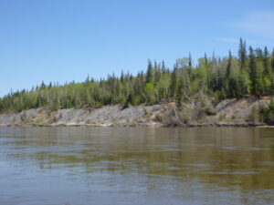
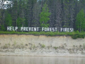
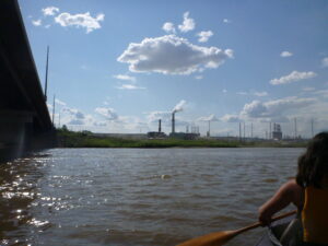
Leaving Fort McMurray, the river has changed demeanor completely. No longer is it the fast water through limestone canyons, but is slow, and meandering along its way to Lake Athabasca between islands and shallows. We were surprised at Fort McMurray, we had expected to see big industry and had seen none, only a clean, very wealthy town. This soon changed as we paddled on however, and soon we saw the true picture of oilsands appear. A few km down river we began to see huge swathes of bare earth with machinery constantly on the move. Beyond this, we then saw the refinery. It is something else. The constant sound of guns (sounds like cannon) being used to deter birds from landing in vast waste pools, huge earth moving vehicles and trucks constantly on the move, with the background hiss of the chimneys and towers which they burn the natural gas they do not use, some spitting flame, others a constant high-heat blue, and many large chimney stacks billowing smoke and steam. It is shocking. I have a car, and see the need for oil in our day to day lives, but there must be a cleaner way to extract and use it. Little wonder then that the Athabasca River is a National Heritage River. But only in Jasper National Park. After this, it is apparently not worthy of Heritage status which is a shame as it is a beautiful river, and rich in history.
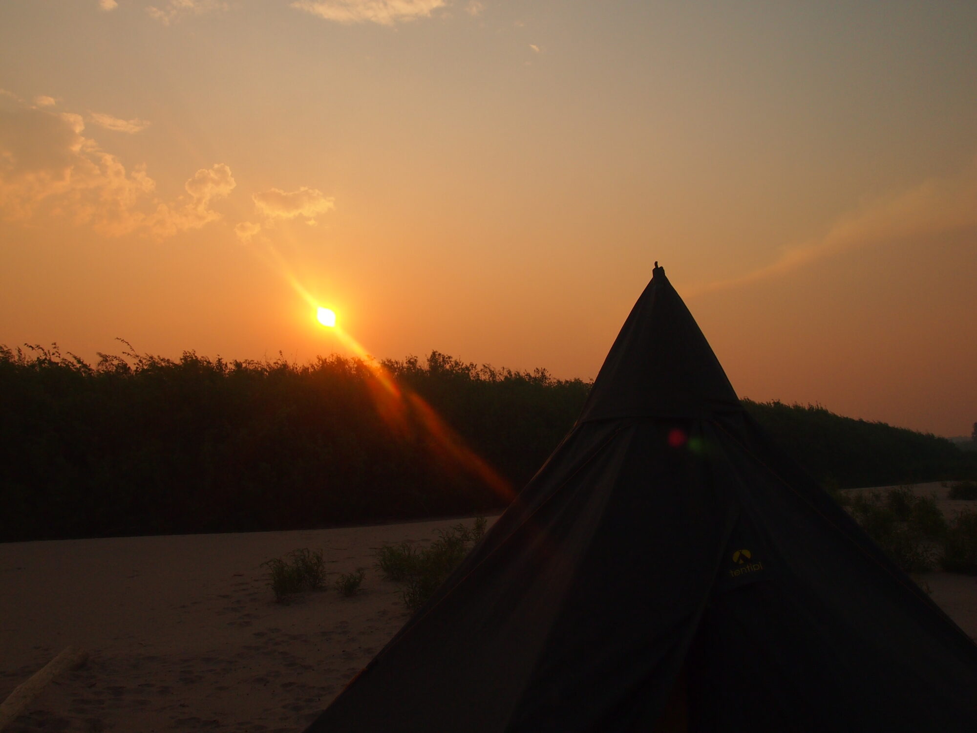
We have been caught in some bad weather, in one instant we were paddling hard to keep ahead of a thunderstorm which began rumbling behind us. We did the best we could, paddling for almost 10km hoping and thinking it was moving to the West until thunder sounded all around us, lightning striking the ground on the land ahead of us, which was the only direction we saw with clearer skies. On the river was not a good place to be. We stopped at the first viable site we could find; a small patch of earth on the edge of an island otherwise covered in dense, small willow bushes. Finding the earth to be more like clay than sand helped us a great deal, holding our pegs and storm-cords for the tipi down tight. It took only a few minutes to put up, but felt much longer in driving rain, howling winds and crashes of thunder, seeing lightning strikes twice more before we had finished. The three of us went inside and spent almost the next 2hrs waiting for the storm to end. The thought that our centre-pole for the tipi is made of metal and was the tallest thing around did cross my mind once or twice, especially as the thunderclaps began directly above us, sounding as though they then rolled around the tipi and across all horizons. An amazing experience.
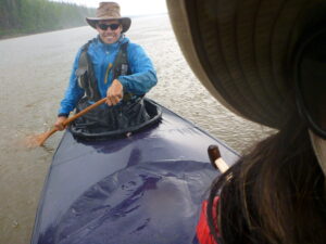
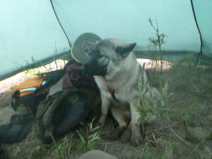
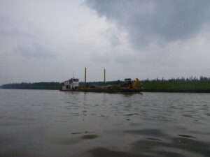
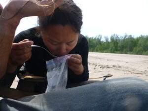
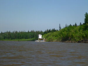
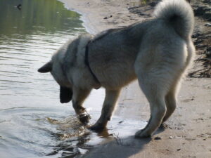
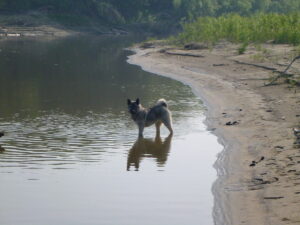
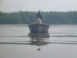
Our progress is slow on the river, with there beuing barely any currrent it is hard for us to move any faster than around 5km/hr, meaning we paddle for around 7hrs a day. Its certainly showing in our muscles! We met a tug-boat pushing a couple of platforms upriver with cargo on which was fascinating to watch as it had 2 guys in a motor boat out in front poling the river, finding the route so that the much larger boat could come through. Even our canoe has touched the bottom of the river in places so we know how shallow areas can be, it must take them such a long time to get anywhere, and they must be skilled to move it around. We were impressed. We also were told that the insects that had plagued us before were perhaps Dragonfly. I love them as adults, but it makes it no less horrible when they infested the tipi if correct. We are unsure what they are, however, but will put some pictures up of them so if anyone knows, please tell us!
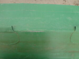
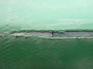
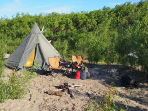
We have also had our first major repairs. I have been progressively reducing the amount of fabric in my waterproof jacket by using the campfire to put what I like call ‘ventilation holes’ in it. It hasn’t helped in the rain! We have also burnt holes in our dry-bags, the tipi, our camp chairs (we bought some cheap ones from Zellers in Fort McMurray) – actually it was Vicki’s chair not mine, but as it may have been indirectly and completely my fault, is now my chair. I like to think of these as ventilation holes. These were all patched easily. The major repair has been the canoe. It appears that rubbing along the sides of the canoe (I think it was the limestone ledges before and just after Fort McMurray) has worn where the aluminium poles run along the outer length of the middle of the canoe, causing it tear. In most places, I have just reinforced the areas to prevent any tears or future wear, but in one spot we had a tear that ran over 4" where you could see the metal pole. Rather concerning, so that was patched. Unfortunately we were camped on a sandy beach at the time in high winds, and as the only place to camp and it had to be repaired, it has a nice ring of sand around the patch where the glue held the grains. Each patch tells a story, right? In Fort Smith we shall receive in our supplies package that we had sent up by a friend (thanks Mike) which inlcude more glue, so shall add reinforcement strips to the bottom of the canoe. No damage there yet, but am seeing lighter strips on the fabric where it is slowly being worn, so want to protect it.
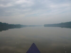
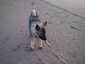
Continuing to paddle, we moved into the Peace-Athabasca Delta which I believe isthe largest inland Delta in the world, but was not as we expected. We travelled along the main route (Fletcher Channel) before encountering a local guy on a motor boat with 2 dogs (one of his dogs is related to the orange one in Disney’s ‘Snow Dogs’ movie) who advised us to cut across onto the Embarras (another channel of the Athabasca leading to Lake Athabasca) around 15km upriver as it would save us time on the Lake and no-one really takes Fletcher that far up. We thought about it, and after camping where the Fletcher had a channel cutting across found the route would save us over 10km in travel, so took that. Actually, the route that we took, moving along the Fletcher then taking Canoe Portage as it is called onto the Embarras and then up to the Lake also saved us distance and time, so was the best option. It is just not quite as scenic. With the river turning less on the Fletcher, the current is faster and we were keen to get to Fort Chipewyan, the end of the Athabasca Stage and the beginning of Stage III; Slave River and Great Slave Lake. I had expected the Delta to be intricate, connecting channles criss-crossing between swamp, marshland and grassland but was not. The main channels were easy to follow, and the water so shallow there were not many options for us to turn off and get lost, especially with the main channels being so obvious.
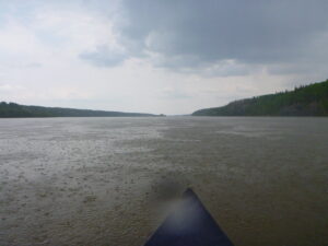
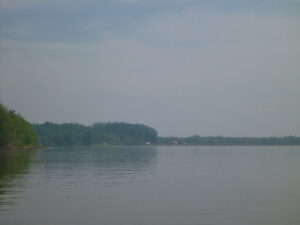
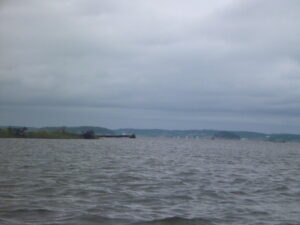
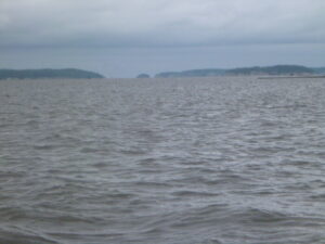
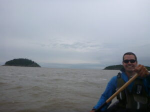
It was the day we travelled to Fort Chipewyan (Fort Chip as it is known) and had to cross Lake Athabasca that is most note-worthy for the paddling throughout this last section. It was windy and raining when we awoke and broke camp (packed away). We did not have breakfast, only a chocolate/banana drink that we had rehydrated throughout the night (one of Vicki’s marvellous creations, really delicious) so that we could get to the Lake early. This did not happen, with the river being so slow it took us 3hrs to paddle 15km to the edge of the Lake and the end of the Delta. All my research before the trip had told me that paddler’s should never attempt to cross the Lake under any circumstance, it being so treacherous. Well, thats just what we had to do. In rain and high winds. We had planned to have lunch and then hit the Lake, paddle hard alond the edge moving South-West along the shore, until we could cut across a short gap in front of the drainage into Rivieres des Rochers (when this meets the Peace River, the two rivers merge and become the Slave River) and not have to paddle across open water for more than about 2km. An interesting side note here, if the Peace River is at high flow it can push the Riviers des Rochers backwards, causing it to flow the opposite direction to what is should, back into Lake Athabasca. Thankfully not a problem for us here at the moment. When we emerged from the Delta, we found a passage had been marked by flags indicating the deeper channel for the motor boats that pass through. We constantly tried and tried again to move away from the channel and into the shallows to follow the shore, but it didn’t work. It was so incredibly shallow we couldn’t even get the paddles into the water and kept having to move back into the channel and further out into the lake. Athabasca Lake is 283km long, and 50km across at the widest point. Needless to say when the winds blow, they howl. It is long, and generally follows a diagonal line running from South-West to North-East. On the day we crossed, the wind was coming from the North-East, blowing towards the South-West, so crossing almost the entire Lake before encountering our little boat. By the time we could turn towards shore, were were halfweay across the lake, the full width being around 10km at this point. There is a chain of islands which I was hoping we could move behind and hop between, limiting our time on open water but it took such time to get there. We were having to tack across the Lake (this is where you move with, and then against the wind to travel along, it increases the distance, as you zig-zag along and do not travel in a straight line) to limit the time we broadsided the wind and very high waves, cresting white at the top. We would be lifted high, the stern (back) first, followed by the bow (front), and surged forwards when with the waves. When against, the bow is lifted high and we would crash down into the surf when the canoe reached the tipping point, dropping the bow down and the stern upwards. It was thrilling, a real adrenaline drive as we pushed hard for 2hrs having eaten nothing all day. With the Delta having turned into swamp at the edge of the Lake there was nowhere we could have stopped to eat before meeting the Lake as we had originally planned. It worked, and we arrived in the little, more Northerly boat inlet at Fort Chipewyan a little after 14:00.
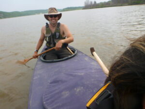
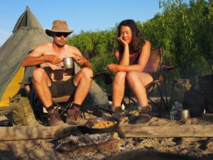
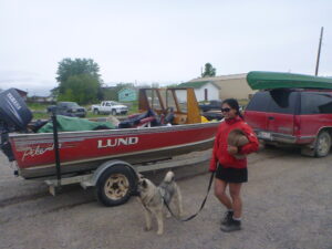
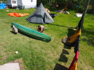
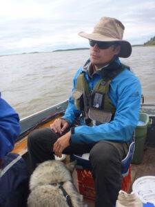
We had barely got out the canoe and were trying to straighten our backs when a truck pulling a boat stopped and a local Mikisew (Cree) guy by the name of Robert Grandjambe leapt out shouting ‘you must be the paddlers!’. Well, we had barely said a word before the canoe was on top of the truck, our gear was loaded, and we were on our way to his home to be greeted with freshly brewed coffee. We have stayed with him 2 days, heading off tomorrow to continue our journey. He has been a gracious host, and a great guide to the area with all its complexity and history we could not hope to understand without insider help. He runs a boat-tour in the summer, cabin rental and is the only dog-sled operator in winter here, so a good person to know, and very eager to help in any way he could. We went back out onto the Lake in his motor boat shortly afterwards to collect freshly caught Pickerel from his net which we ate for dinner. To our great entertainment, none of the boats went out beyond the islands along our route as the Lake was so rough that day. We were still coming down from the excitement of the paddle and had a good laugh about that. Instead, we went to the mouth of Rivieres des Rochers for the catch. We did more minor repairs to our gear yesterday, and with Roberts help and his workshop, we have built a rig for a sail which I intent to put up perhaps on the Slave River, but mainly on the Mackenzie River. It would be great if it works! I will be sure to put a picture up of it in action.
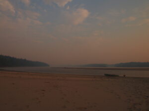
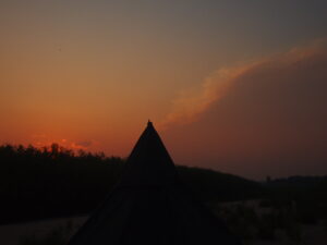
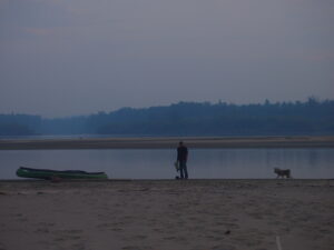
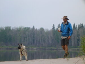
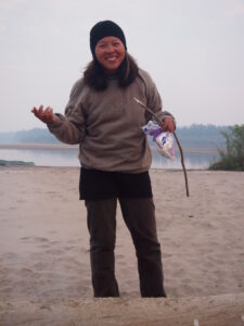
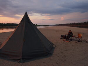
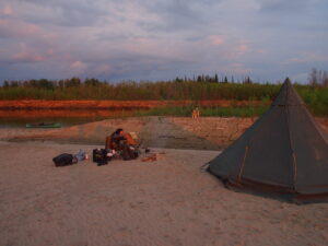
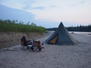
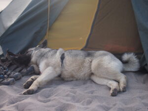
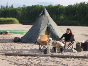
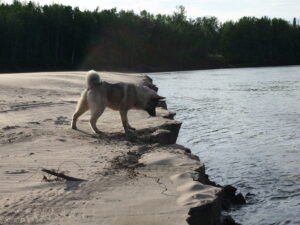
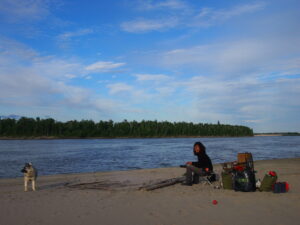
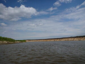
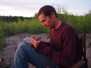
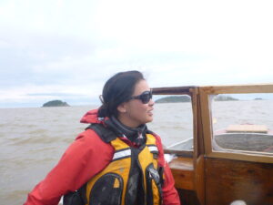
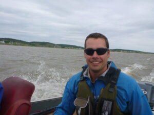
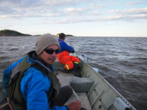
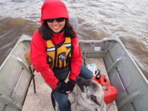
We head off towards Fort Smith which we should arrive to in about 1 week, so hope to update again then. The pictures that follow are from the Town of Athabasca, all the way to Fort Chipewyan. There are many, so I hope you enjoy!
Sounds like you are having a fantastic time, love logging in to hear the updates. Keep up the good work you are both doing brilliantly – sending lots of good wishes and love Sian, Christine & Roger x
“Stage II Complete – Thunderstorms, Repairs & The Crossing of Lake Athabasca |
Paddle The Waters” genuinely got myself hooked on ur web-site!
I personallydefinitely will be returning way more often.
With thanks -Carlo